MaywoodNJ060405H.jpg)

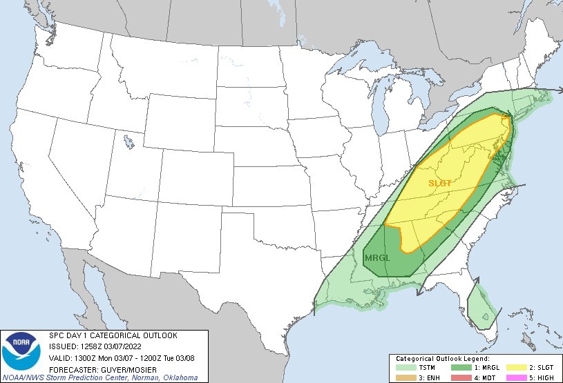
That would be on the line marking a SLIGHT chance and a MARGINAL chance.
Have I already told you how much I HATE the language the National Weather Service uses? Ask the next five people you meet if they can say which is the larger risk: SLIGHT or MARGINAL? ENHANCED or MODERATE?
- 1-MRGL (dark green) - Marginal risk - An area of severe storms of either limited organization and longevity, or very low coverage and marginal intensity.
- 2-SLGT (yellow) - Slight risk - An area of organized severe storms, which is not widespread in coverage with varying levels of intensity.
- 3-ENH (orange) - Enhanced risk - An area of greater (relative to Slight risk) severe storm coverage with varying levels of intensity.
- 4-MDT (red) - Moderate risk - An area where widespread severe weather with several tornadoes and/or numerous severe thunderstorms is likely, some of which should be intense. This risk is usually reserved for days with several supercells producing intense tornadoes and/or very large hail, or an intense squall line with widespread damaging winds.
- 5-HIGH (magenta) - High risk - An area where a severe weather outbreak is expected from either numerous intense and long-tracked tornadoes or a long-lived derecho-producing thunderstorm complex that produces hurricane-force wind gusts and widespread damage. This risk is reserved for when high confidence exists in widespread coverage of severe weather with embedded instances of extreme severe (i.e., violent tornadoes or very damaging convective wind events).
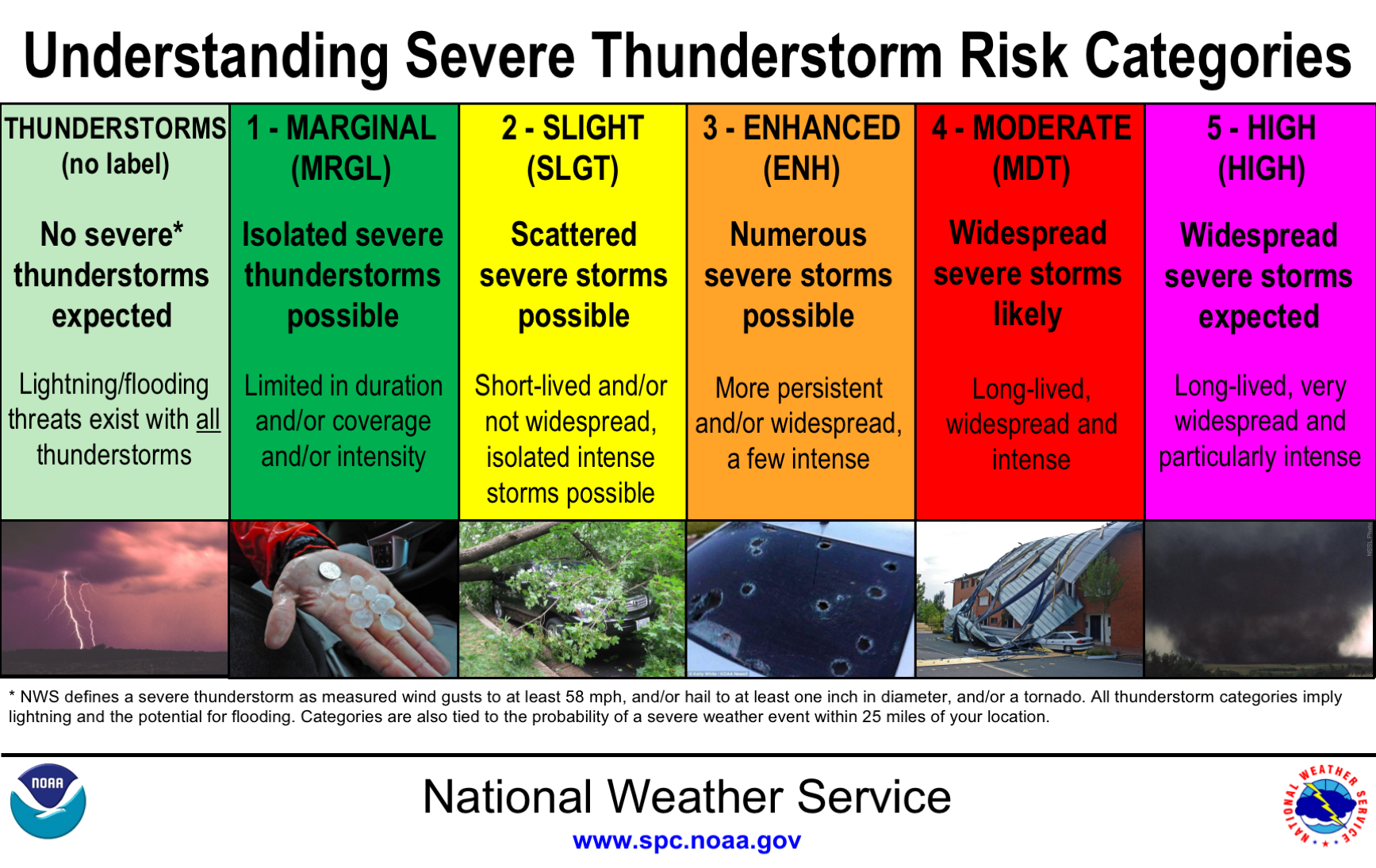
The forecasters at Alabama News Network have added a reference to the category..."Two out of five" "Four out of five" to explain it, and that helps. But I still wonder...did the NWS people do ANY field testing of the first four titles? Awful.
No comments:
Post a Comment